

Brief
Feasibility study using OLS survey for development of waterdromes as an alternative to airports on land with an aim to promote regional air connectivity to boost trade and reduce burden on other
modes of transport.
Region
APAC
Challenges
Impact
Enabled informed decision making for development of the waterdrome.
Services
OLS
Brief
Assist the development of the Airport which will be a future facilitator for tourism, training, trade and transport of the upcoming Al Ain City.
Region
MID
Challenges
Impact
ICAO safety regulations were met through ADL recommendations for obstacle marking, lighting and developing obstacle control and monitoring measures.
Services
OLS

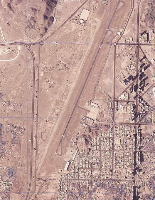
Brief
OLS and eTod survey for obstacles for latest Aerodrome data and charts for an Airport that is a pioneer in ICAO and DGCA compliances.
Region
APAC
Challenges
Impact
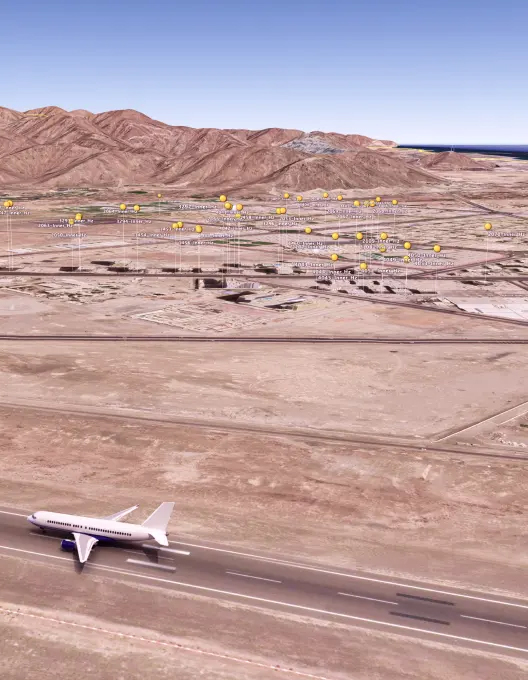
Brief
ICAO compliant eTOD and AIXM required for Aviation Regulation in the highly active and dynamic international airport.
Region
MID
Challenges
Impact
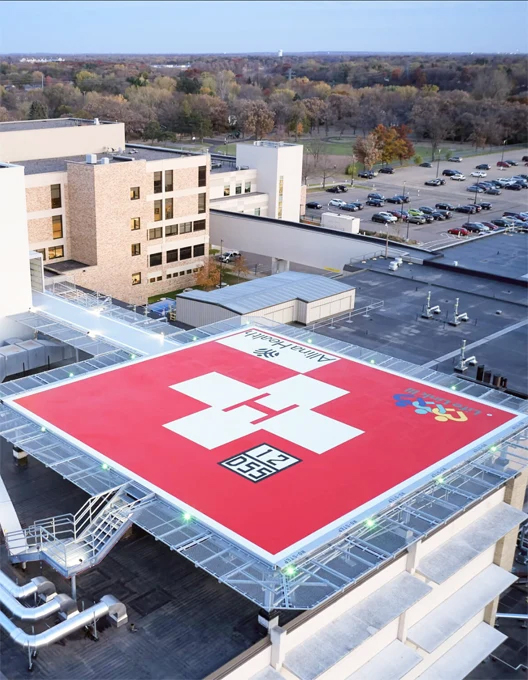
Brief
OLS survey for development of Helipad in densely populated area for quick response and medical help.
Region
MID
Challenges
Impact
Services
OLS
Brief Conduct site feasibility study for helipad construction with OLS Survey for operations before commencement.
Region
APAC
Challenges:
Impact
Services
OLS

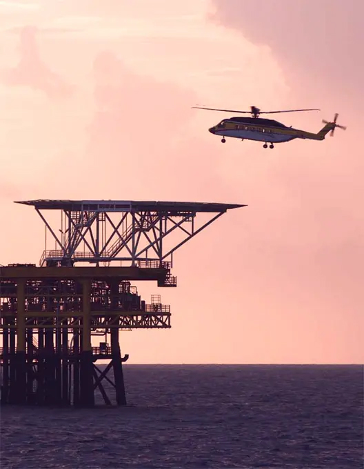
Brief Conducting OLS survey to assist in installation of HAPI to commence night VFR operations on offshore rigs.
Region
APAC
Challenges
Impact
Services
OLS
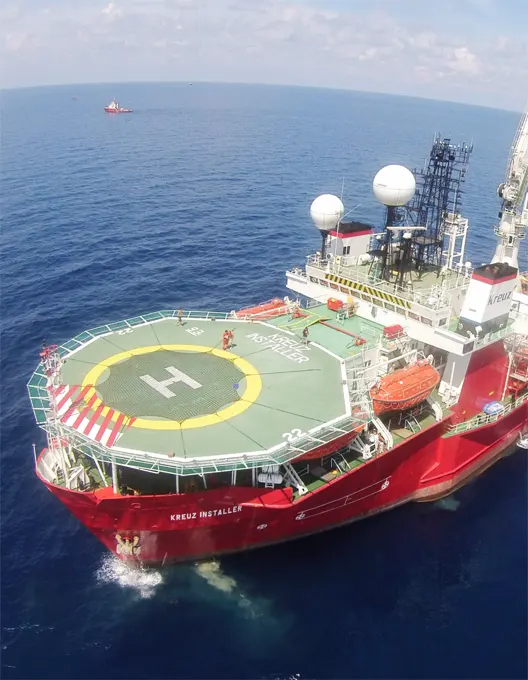
Brief Conducting OLS survey to assist in installation of HAPI to commence night VFR operations on a vessel.
Region
APAC
Challenges
Impact
Services
OLS

Brief
Conducting OLS survey for identifying most effective helicopter landing and take-off path.
Region
MID
Challenges
Impact
Services
OLS
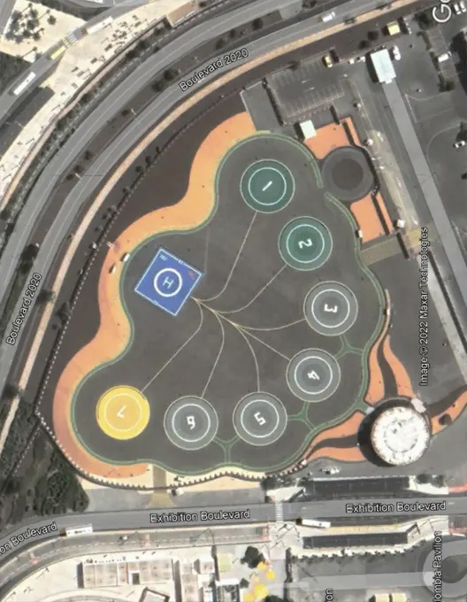
Brief Heliport operations aimed at providing services to World leaders and VVIPs visiting the Dubai Expo 2020. Emergency medical services. 24/7 all weather Heliport operations.
Region
MID
Challenges
Impact
Services
OLS

Brief
Height clearance survey required for a land development project involving construction of around 15 skyscrapers on a 25000 sq mtr area of land close to the airport.
Region
APAC
Challenges
Impact
Construction permission granted after survey using various benefits of shielding.
Services
Height Clearance Survey

Brief
Survey of 60 identified windmill locations for a massive renewable energy project and get height clearance through assessment report and submission of relevant documents.
Region:
APAC
Challenges
Impact
Data assimilation and analysis after survey resulted in location identification and clearance from authorities for constructing windmills.
Services
Height Clearance Survey |
NOC

Brief
Survey to suggest appropriate locations for towers on a 250 km stretch of transmission line traversing through forests, desert and rivers, to get height.
Region
APAC
Challenges
Impact
Data assimilation and analysis after survey resulted in location identification and clearance from authorities for installation of transmission lines.
Services
Height Clearance Survey |
NOC
Brief
To provide the State with an advanced solution for a globally accepted AIM publication in compliance with ICAO mandates regarding ASBU block upgrades.
Region
APAC
Challenges
Impact
Services
eAIP
Brief
Replacing the manual process of granting height clearance for all stakeholders for new constructions with a smoother online process.
Challenges
Impact
Services
NOC Software application